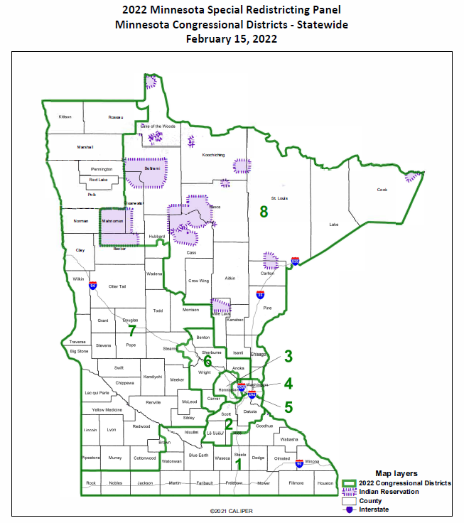
Population shift leads to boundary changes for Minnesota’s 7th District
ST. PAUL, Minn. – A Minnesota panel of five judges has released newly drawn congressional and legislative district maps.
Minnesota’s 7th District, which nearly covers the state’s entire western border, would no longer include the Northwest Angle, Lake of the Woods, and the White Earth and Red Lake Reservations.
Urban population growth resulted in more state legislative districts in the Twin Cities metro area and suburbs. Shrinking or stagnated populations in rural districts caused them to get larger geographically.
A preliminary list from Senate Republicans showed four incumbent pairings of Republican senators that ended up in the same district due to shifted boundaries, two pairings between Democratic senators and one district where a Republican and Democrat were paired.
Unless successfully challenged in court, the panel’s boundary recommendations would remain in effect for 10 years.