Red River Continues To Rise In Grand Forks & East Grand Forks
Crews are installing the floodwalls at Lincoln Drive Park and Elks Drive
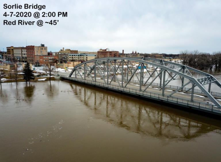
GRAND FORKS, N.D. — Northern Plains UAS Test Site is giving us a look at how high the water is in Grand Forks and East Grand Forks.
This is a drone shot of the Sorlie Bridge which has been closed to traffic.
You can see chunks of ice jammed along the north pedestrian bridge over the Red River.
It is currently at 47 feet and expected to climb to 48 feet by the end of the week.
Crews are installing the floodwalls at Lincoln Drive Park and Elks Drive.
Northern Plains UAS is one of seven FAA test sites for unmanned aerial systems, or drones.
Flights like these in Grand Forks demonstrate how UAS can be used to improve public safety efforts.