New Mapping Tool Shows Flooding Risk Across North Dakota
The tool is intended to help people make informed decisions about flood protection.
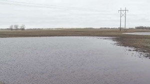
BISMARCK, N.D.–The North Dakota Water Commission has unveiled a new interactive mapping tool that provides information on potential flooding in the state.
State risk map coordinator Laura Horner says the map shows where flooding might occur and to what extent it could happen in various scenarios.
The North Dakota Risk Assessment Mapservice was on display Wednesday at the Bismarck Event Center.
The tool is intended to help people make informed decisions about flood protection and provide resources to community leaders who want to keep citizens safe.
It uses base level engineering that combines elevation data with advancements in modeling technology.
The state partnered with the Federal Emergency Management Agency for the project.