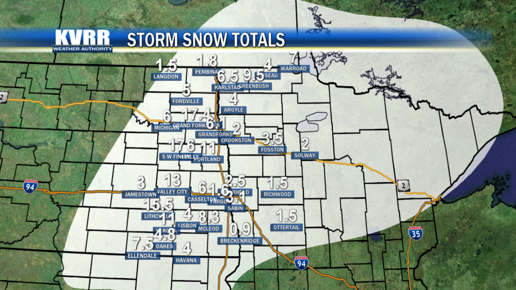
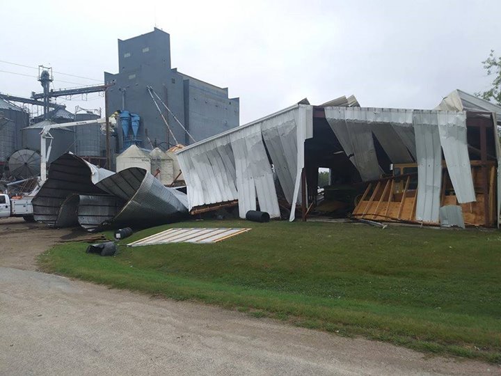
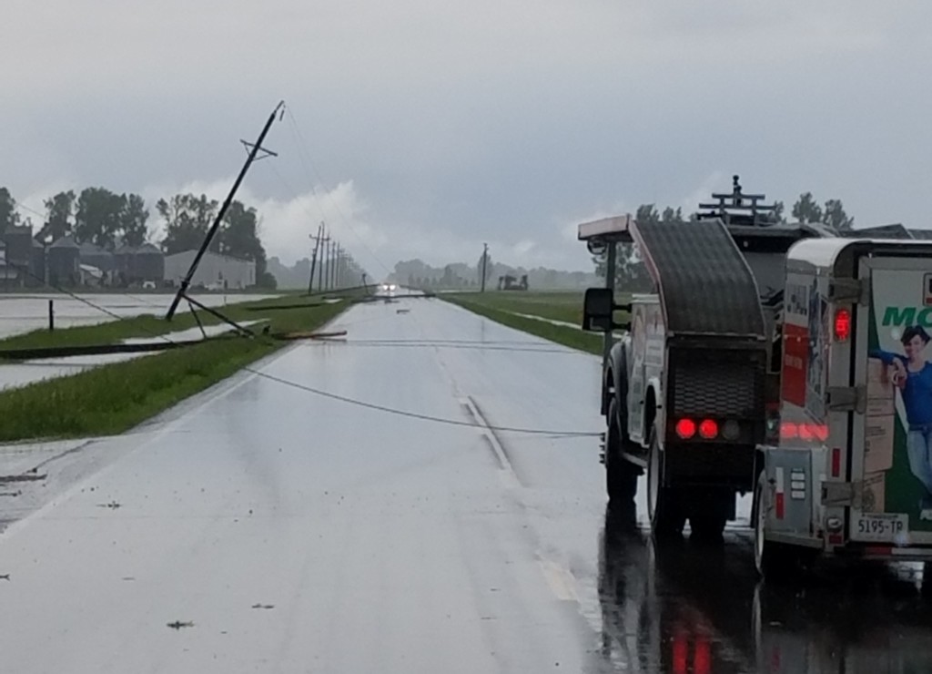
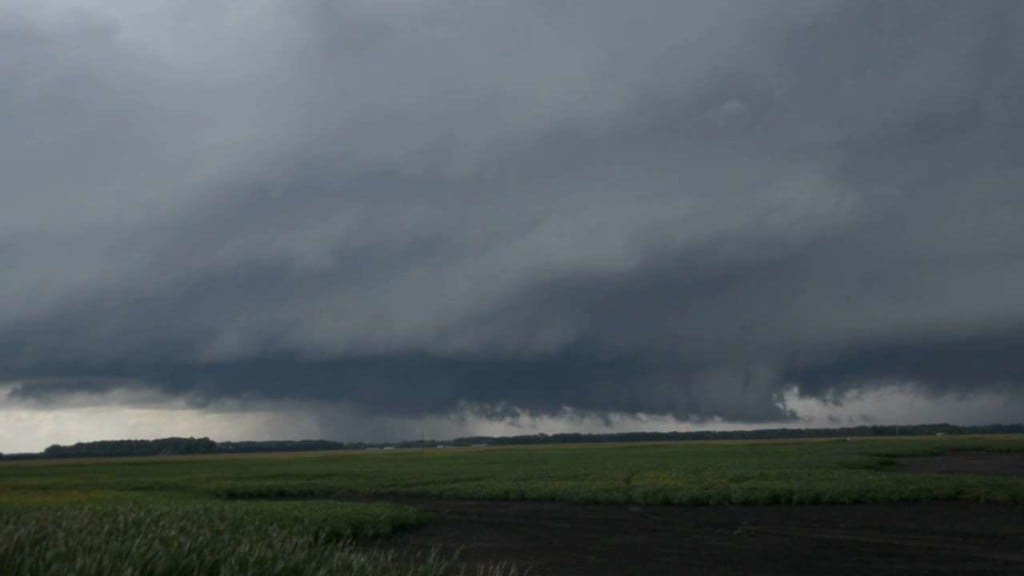
Weather Blog

Snow Totals from October 10th, 2018

Snow Totals from the National Weather Service LOCATION AMOUNT TIME/DATE LAT/LON …MINNESOTA… …BECKER COUNTY… 5 NNW CORMORANT 2.2 IN 0700 AM 10/11 46.80N/96.10W 3 NE RICHWOOD 1.5 IN 0150 PM 10/10 47.01N/95.77W 3 ESE WESTBURY 1.1 IN 0700 AM 10/11 46.90N/95.84W …BELTRAMI COUNTY… PUPOSKY 3.5 IN 0800 AM 10/11 47.68N/94.91W 4 NW LAVINIA 2.0 IN 0800 AM 10/11 47.55N/94.88W 5…

NWS Summary of Polk & Clearwater Counties Tornadoes

Tornado 1 – 9 SW Winger to 5 WNW Fosston NORMAN/POLK COUNTIES Date August 26, 2018 Time (Local) 11:30 – 11:46 pm EF Rating EF-1 Est. Peak Winds 110 mph Path Length 16 miles Max Width 100 yards Injuries/Deaths None Summary: This tornado first touched down near a farmstead 9 miles southwest of Winger. Numerous barns, sheds, and outbuildings were…

PRELIMINARY LOCAL STORM REPORT for August 26th

PRELIMINARY LOCAL STORM REPORT…SUMMARY NATIONAL WEATHER SERVICE EASTERN ND/GRAND FORKS ND 1202 PM CDT MON AUG 27 2018 ..TIME… …EVENT… …CITY LOCATION… …LAT.LON… ..DATE… ….MAG…. ..COUNTY LOCATION..ST.. …SOURCE…. ..REMARKS.. 0110 AM HAIL TOWER CITY 46.93N 97.68W 08/26/2018 E0.88 INCH CASS ND PUBLIC PICTURE RELAYED THROUGH LOCAL MEDIA SHOWS NICKEL SIZED HAIL. 0210 AM HAIL DAVENPORT 46.71N 97.07W 08/26/2018 E2.50 INCH…

Storm Reports for Friday June 8th

Power polls down in Reynolds, ND Friday. Photo from Kelly Fox. PRELIMINARY LOCAL STORM REPORT…SUMMARY NATIONAL WEATHER SERVICE EASTERN ND/GRAND FORKS ND 155 PM CDT SUN JUN 10 2018 ..TIME… …EVENT… …CITY LOCATION… …LAT.LON… ..DATE… ….MAG…. ..COUNTY LOCATION..ST.. …SOURCE…. ..REMARKS.. 0307 PM FUNNEL CLOUD 5 N VALLEY CITY 47.00N 98.02W 06/08/2018 Barnes ND 911 CALL CENTER CALL FROM VALLEY CITY…

Ice Out Dates

Lakes are still ice covered across the region, though this weeks warmer and windy weather should help break-up the ice. We have a look at a few Minnesota lakes and when there median and record ice outs are. Categories: Weather Blog, Weather Notes Tags: Fishing Opener, Ice out, Lakes

Snow Totals from March 26th Winter Storm

Higher Snow Amounts Reported in the Lakes Country

Here’s a list of reported snowfall totals from around the region: – Park Rapids, MN – 8.0″ – Sebeka, MN – 7.0″ – Nimrod, MN – 6.5″ – Osage, MN – 6.2″ – Mehnaga, MN – 6.0″ – New York Mills, MN – 6.0″ – Ottertail, MN – 5.5″ – Deer Creek, MN – 5.5″ – Evergreen, MN – 5.3″…

Snow Reports from March 25th Winter Storm

East Grand Forks reportedly received 12 inches of snow

PRELIMINARY LOCAL STORM REPORT…SUMMARY NATIONAL WEATHER SERVICE EASTERN ND/GRAND FORKS ND 942 PM CDT SUN MAR 25 2018 ..TIME… …EVENT… …CITY LOCATION… …LAT.LON… ..DATE… ….MAG…. ..COUNTY LOCATION..ST.. …SOURCE…. ..REMARKS.. 0100 PM HEAVY SNOW GRAND FORKS 47.92N 97.07W 03/25/2018 M2.0 INCH GRAND FORKS ND OFFICIAL NWS OBS STORM TOTAL THROUGH 1 PM. 0100 PM HEAVY SNOW GRAND FORKS 47.92N 97.07W 03/25/2018…